机载遥感系统在精准农业中的应用
杨成海( )
)
)
Airborne remote sensing systems for precision agriculture applications
Chenghai Yang()
)
.
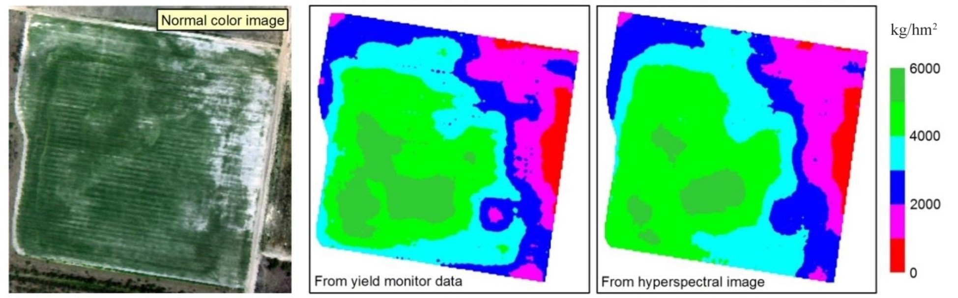
Fig. 5. RGB color image and yield maps generated from yield monitor data and based on seven significant bands in a 102-band hyperspectral image for a 14hm2 grain sorghum field (Adapted from [69])