AVIRIS高光谱数据空-谱特征在植被分类中的对比分析
付元元1,2, 杨贵军1,2( ), 段丹丹3, 张永涛4, 顾晓鹤1, 杨小冬2,5, 徐新刚2, 李振海2
), 段丹丹3, 张永涛4, 顾晓鹤1, 杨小冬2,5, 徐新刚2, 李振海2
Comparison analysis of spatial and spectral feature in vegetation classification based on AVIRIS hyperspectral image
Yuanyuan Fu1,2, Guijun Yang1,2(), Dandan Duan3, Yongtao Zhang4, Xiaohe Gu1, Xiaodong Yang2,5, Xingang Xu2, Zhenhai Li2
), Dandan Duan3, Yongtao Zhang4, Xiaohe Gu1, Xiaodong Yang2,5, Xingang Xu2, Zhenhai Li2
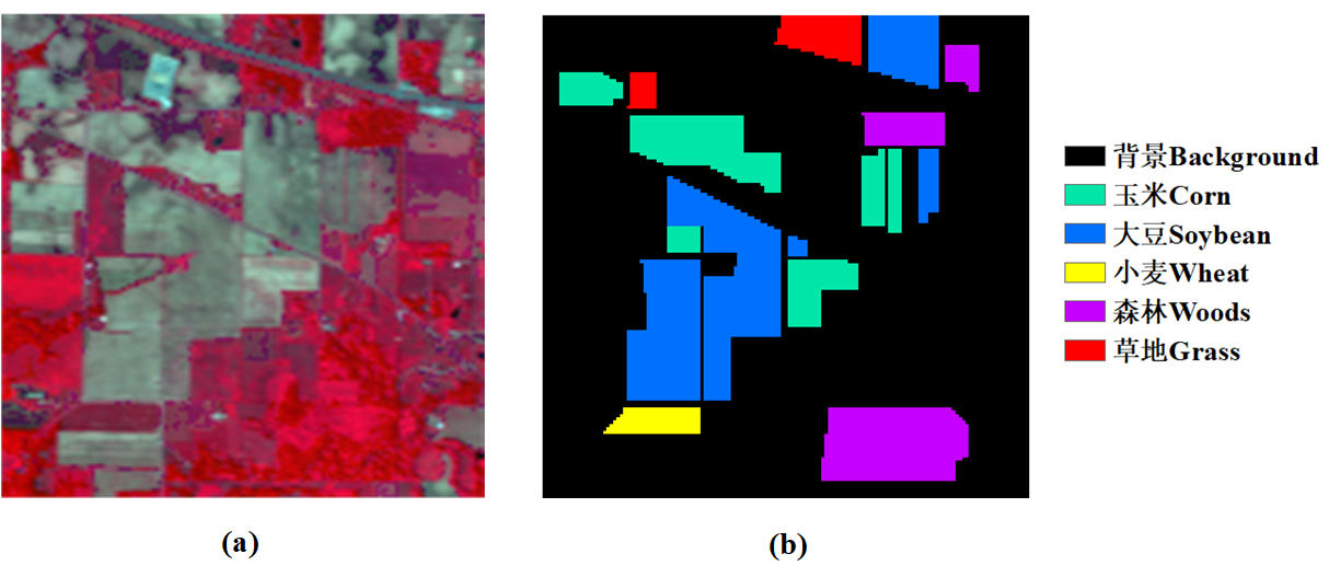
图1. (a)AVIRIS高光谱影像假彩色合成图像(波段50,27和17);(b)对应类别的地面真实标记图像
Fig. 1. (a) AVIRIS hyperspectral image of three-band color composite image (band 50, 27 and 17); (b) Ground truth