基于不同空间分辨率无人机多光谱遥感影像的小麦倒伏区域识别方法
Wheat Lodging Area Recognition Method Based on Different Resolution UAV Multispectral Remote Sensing Images
基于不同空间分辨率无人机多光谱遥感影像的小麦倒伏区域识别方法 |
| 魏永康, 杨天聪, 丁信尧, 高越之, 袁鑫茹, 贺利, 王永华, 段剑钊, 冯伟 |
|
Wheat Lodging Area Recognition Method Based on Different Resolution UAV Multispectral Remote Sensing Images |
| WEI Yongkang, YANG Tiancong, DING Xinyao, GAO Yuezhi, YUAN Xinru, HE Li, WANG Yonghua, DUAN Jianzhao, FENG Wei |
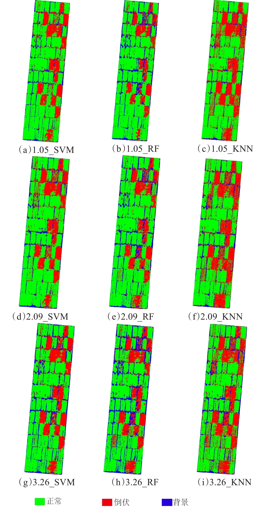
| 图3 不同空间分辨率影像全特征集的小麦倒伏分类图 |
| Fig. 3 Wheat lodging classification map with full feature set of different spatial resolution images |
|
|